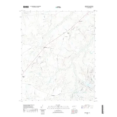
2019 Map of Middleburg
USGS Topo · Published 2019About this map
Middleburg and Hickory Valley anchor this portion of Hardeman County, where the Tennessee landscape transitions from agricultural drainages into developed recreational waters. The topography is defined by a dense network of tributaries including Pleasant Run, Hamer Cr, and Welcome Ussery Cr, which carve through the terrain south of Bolivar. Local history is preserved in several family and community burial grounds, such as Ussery Cem, Clifft Cem, and Avent Cem, which are scattered among the timbered tracts and winding secondary roads. In the southeast, the geography shifts toward modern residential and leisure development around Grand Valley Lake and the managed waters of Spring Cr Ranch Lake Number One and Spring Cr Ranch Lake Number Two. Aviation and transit are represented by the presence of William L Whitehurst Field, located near the intersection of several local routes including Owen Way and Sugar Hill Loop.
Find a feature on this map
70 named features on this map. Tap any name to fly to it.
Don’t see what you’re looking for? This feature index may not catch every label — zoom into the map to look around manually.
Map Details
Editions of this 2019 Middleburg Map
This is the sole edition of this map. No revisions or reprints were ever made.
Other maps of this area

1950 · Hebron
USGS Topo · 1:24,000

1950 · Middleburg
USGS Topo · 1:24,000

1950 · Middleton
USGS Topo · 1:24,000

1950 · Grand Junction
USGS Topo · 1:24,000

1951 · Middleton
USGS Topo · 1:24,000

1951 · Middleburg
USGS Topo · 1:24,000

1951 · Hebron
USGS Topo · 1:24,000

1951 · Hickory Valley
USGS Topo · 1:24,000

1951 · Grand Junction
USGS Topo · 1:24,000

1952 · Saulsbury
USGS Topo · 1:24,000