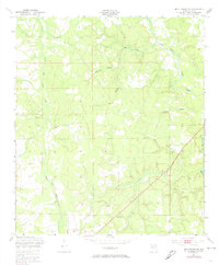
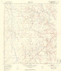
1949 Map of Middleburg SW
USGS Topo · Published 1974About this map
North Fork Black Creek and its many winding tributaries, including Duckwater Branch and Dillaberry Branch, dominate this landscape in Clay County. In the post-war era, the southern portion of the area is defined by the Camp Blanding Military Reservation, which includes a specific Machine Gun Range and an unidentified Quarry. These military and industrial footprints sit alongside traditional rural landmarks like Oak Grove Ch and a local Cem. The drainage patterns of Mill Creek and Bull Creek illustrate the low-lying, water-rich environment typical of this part of Florida before significant modern development altered the surface hydrology. This map serves as a primary record of the intersection between local community life and federal military activity during the late 1940s.
Find a feature on this map
14 named features on this map. Tap any name to fly to it.
Don’t see what you’re looking for? This feature index may not catch every label — zoom into the map to look around manually.
Map Details
Editions of this 1949 Middleburg SW Map
5 editions found
Other maps of this area

1918 · Middleburg
USGS Topo · 1:62,500

1918 · Lawtey
USGS Topo · 1:62,500

1941 · Starke
USGS Topo · 1:62,500

1941 · Middleburg
USGS Topo · 1:62,500

1942 · Ates Creek
USGS Topo · 1:62,500

1948 · Starke
USGS Topo · 1:50,000

1948 · Jacksonville
USGS Topo · 1:250,000
1949 · Middleburg SW
USGS Topo · 1:24,000

1949 · Fiftone
USGS Topo · 1:24,000
1949 · Starke
USGS Topo · 1:24,000