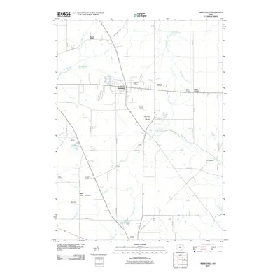
2010 Map of Middlefield
USGS Topo · Published 2010About this map
Middlefield stands as the central hub of this Northeast Ohio landscape, where the agricultural traditions of the region meet growing transportation infrastructure. The map reveals a high density of sites with deep local genealogical value, including the Amish Cemetery, Yoder Cemetery, and Burroughs Cemetery. Aviation history is notably present with three separate facilities: Geauga County Airport, Hosmer Airfield, and Pauls Airport.
Find a feature on this map
51 named features on this map. Tap any name to fly to it.
Don’t see what you’re looking for? This feature index may not catch every label — zoom into the map to look around manually.
Map Details
Editions of this 2010 Middlefield Map
This is the sole edition of this map. No revisions or reprints were ever made.
Other maps of this area

1904 · Chardon
USGS Topo · 1:62,500

1905 · Bristolville
USGS Topo · 1:62,500

1905 · Garrettsville
USGS Topo · 1:62,500

1905 · Jefferson
USGS Topo · 1:62,500

1906 · Chardon
USGS Topo · 1:62,500

1907 · Bristolville
USGS Topo · 1:62,500

1907 · Jefferson
USGS Topo · 1:62,500

1907 · Garrettsville
USGS Topo · 1:62,500

1950 · Cleveland
USGS Topo · 1:250,000

1952 · West Farmington
USGS Topo · 1:24,000
Featured Places
- Mesopotamia Township, OH
- Farmington Township, OH
- Burton Township, OH
- Parkman Township, OH
- Burton Station, OH