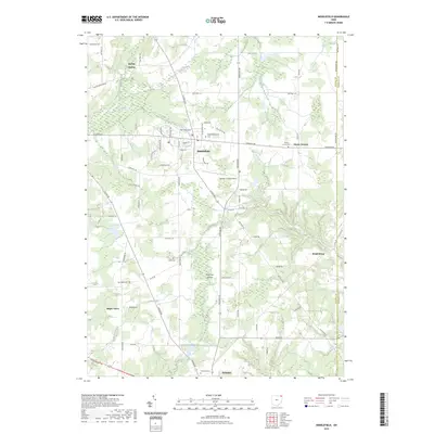
2023 Map of Middlefield
USGS Topo · Published 2023About this map
The Grand River and its varied tributaries, including Tare Creek and Swine Creek, anchor this detailed look at Geauga County. The village of Middlefield serves as a primary hub, showing a blend of residential streets like Almeda Dr and an Industrial Pk near the Geauga County Airport. The surrounding landscape is dotted with smaller settlements and family-named landmarks that speak to the area's deep-rooted community history, such as Hayes Corners and Burton Station.
Find a feature on this map
76 named features on this map. Tap any name to fly to it.
Don’t see what you’re looking for? This feature index may not catch every label — zoom into the map to look around manually.
Map Details
Editions of this 2023 Middlefield Map
This is the sole edition of this map. No revisions or reprints were ever made.
Other maps of this area

1904 · Chardon
USGS Topo · 1:62,500

1905 · Bristolville
USGS Topo · 1:62,500

1905 · Garrettsville
USGS Topo · 1:62,500

1905 · Jefferson
USGS Topo · 1:62,500

1906 · Chardon
USGS Topo · 1:62,500

1907 · Bristolville
USGS Topo · 1:62,500

1907 · Jefferson
USGS Topo · 1:62,500

1907 · Garrettsville
USGS Topo · 1:62,500

1950 · Cleveland
USGS Topo · 1:250,000

1952 · West Farmington
USGS Topo · 1:24,000
Featured Places
- Mesopotamia Township, OH
- Farmington Township, OH
- Burton Township, OH
- Parkman Township, OH
- Middlefield Township, OH