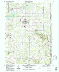
1994 Map of Middlefield
USGS Topo · Published 1997About this map
Middlefield serves as the central hub of this Geauga County landscape, where the upper reaches of the Cuyahoga River and the Grand River originate within miles of each other. The settlement pattern reflects a deeply rooted rural community, connected by historic thoroughfares like Butternut Road and Burton-Windsor Road. Small hamlets and former stops such as Burton Station and Bundysburg are preserved alongside local institutions, including the Mapleview Sch and Troy Church.
Find a feature on this map
48 named features on this map. Tap any name to fly to it.
Don’t see what you’re looking for? This feature index may not catch every label — zoom into the map to look around manually.
Map Details
Editions of this 1994 Middlefield Map
This is the sole edition of this map. No revisions or reprints were ever made.
Other maps of this area

1904 · Chardon
USGS Topo · 1:62,500

1905 · Bristolville
USGS Topo · 1:62,500

1905 · Garrettsville
USGS Topo · 1:62,500

1905 · Jefferson
USGS Topo · 1:62,500

1906 · Chardon
USGS Topo · 1:62,500

1907 · Bristolville
USGS Topo · 1:62,500

1907 · Jefferson
USGS Topo · 1:62,500

1907 · Garrettsville
USGS Topo · 1:62,500

1950 · Cleveland
USGS Topo · 1:250,000

1952 · West Farmington
USGS Topo · 1:24,000
Featured Places
- Mesopotamia Township, OH
- Farmington Township, OH
- Burton Township, OH
- Maple Grove, Troy Township
- Parkman Township, OH