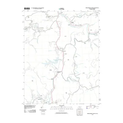
2010 Map of Middlesboro North
USGS Topo · Published 2010About this map
The Cumberland River curves through this corner of Bell County, shaping the industrial and residential development of East Pineville and Wasioto. The presence of the Laurel Cove Amphitheater near Limestone Gap highlights the region's long-standing connection to outdoor community gathering spaces. Transportation and industry follow the natural corridors provided by Yellow Creek and Clear Creek, with the Yellow Creek Bypass and Old Pineville Pike serving as vital connectors between the smaller settlements of Ferndale, Meldrum, and Binghamtown. Genealogists will find a wealth of family history preserved in the numerous upland burial sites, such as the Knuckle Cemetery, Henderson Cemetery, and Peavier Cemetery, which are scattered among the ridges of Canada Mountain and Rocky Face. The landscape is further defined by Cannon Creek Lake, providing a significant water feature south of Clear Creek Springs.
Find a feature on this map
81 named features on this map. Tap any name to fly to it.
Don’t see what you’re looking for? This feature index may not catch every label — zoom into the map to look around manually.
Map Details
Editions of this 2010 Middlesboro North Map
This is the sole edition of this map. No revisions or reprints were ever made.
Other maps of this area

1886 · Cumberland Gap
USGS Topo · 1:125,000

1888 · Cumberland Gap
USGS Topo · 1:125,000

1891 · Cumberland Gap
USGS Topo · 1:125,000

1903 · Pineville
USGS Topo · 1:48,000

1903 · Middlesboro
USGS Topo · 1:48,000

1927 · Middlesboro
USGS Topo · 1:62,500

1930 · Middlesboro
USGS Topo · 1:62,500

1935 · Varilla
USGS Topo · 1:24,000

1935 · Mingo Mountains
USGS Topo · 1:24,000

1935 · Cumberland Gap
USGS Topo · 1:24,000