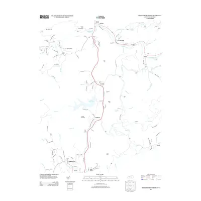
2013 Map of Middlesboro North
USGS Topo · Published 2013About this map
The Old Narrows and the Cumberland River define the northern corridor of this Bell County landscape, where the valley tightens near Wasioto. The settlement pattern follows the drainage of Yellow Cr, with communities like Ferndale and Meldrum established along the transportation routes that cut through the surrounding ridges. To the south, Binghamtown sits near the Yellow Cr Bypass, marking the edge of a more developed urban footprint.
Find a feature on this map
134 named features on this map. Tap any name to fly to it.
Don’t see what you’re looking for? This feature index may not catch every label — zoom into the map to look around manually.
Map Details
Editions of this 2013 Middlesboro North Map
This is the sole edition of this map. No revisions or reprints were ever made.
Other maps of this area

1886 · Cumberland Gap
USGS Topo · 1:125,000

1888 · Cumberland Gap
USGS Topo · 1:125,000

1891 · Cumberland Gap
USGS Topo · 1:125,000

1903 · Pineville
USGS Topo · 1:48,000

1903 · Middlesboro
USGS Topo · 1:48,000

1927 · Middlesboro
USGS Topo · 1:62,500

1930 · Middlesboro
USGS Topo · 1:62,500

1935 · Varilla
USGS Topo · 1:24,000

1935 · Mingo Mountains
USGS Topo · 1:24,000

1935 · Cumberland Gap
USGS Topo · 1:24,000