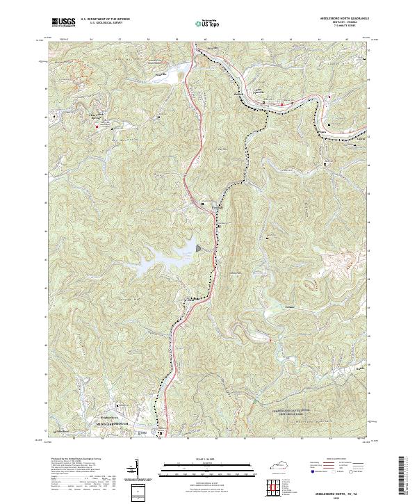
2022 Map of Middlesboro North
USGS Topo · Published 2022About this map
Pine Mountain and the Log Mountains dominate this corridor of the Cumberland Valley, where the Cumberland River cuts through the northern reaches of the Cumberland Gap National Historical Park. The landscape is a complex network of ridges and hollows, from Bear Wallow Gap to the heights of Flag Top. This modern survey details the transition from the concentrated urban footprint of Middlesborough and Binghamtown northward toward Pineville, showing a settled valley floor along Yellow Creek and the Wilderness Rd corridor.
Find a feature on this map
103 named features on this map. Tap any name to fly to it.
Don’t see what you’re looking for? This feature index may not catch every label — zoom into the map to look around manually.
Map Details
Editions of this 2022 Middlesboro North Map
This is the sole edition of this map. No revisions or reprints were ever made.
Other maps of this area

1886 · Cumberland Gap
USGS Topo · 1:125,000

1888 · Cumberland Gap
USGS Topo · 1:125,000

1891 · Cumberland Gap
USGS Topo · 1:125,000

1903 · Pineville
USGS Topo · 1:48,000

1903 · Middlesboro
USGS Topo · 1:48,000

1927 · Middlesboro
USGS Topo · 1:62,500

1930 · Middlesboro
USGS Topo · 1:62,500

1935 · Varilla
USGS Topo · 1:24,000

1935 · Mingo Mountains
USGS Topo · 1:24,000

1935 · Cumberland Gap
USGS Topo · 1:24,000