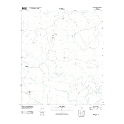
2010 Map of Middleton
USGS Topo · Published 2010About this map
The Trinity River winds along the southeastern boundary of this Leon County landscape, defining a network of seasonal branches and creeks that feed into the river basin. Small rural hubs like Middleton and Cairomiss are connected by a web of farm-to-market roads, including FM 811 and FM 977, which link isolated homesteads and family businesses such as Guys Store and Spillers Store. The map reveals a deeply rooted community structure, evidenced by the high density of family and community burial grounds, from New Salem Cemetery in the north to Pleasant Grove Cemetery in the south.
Find a feature on this map
49 named features on this map. Tap any name to fly to it.
Don’t see what you’re looking for? This feature index may not catch every label — zoom into the map to look around manually.
Map Details
Editions of this 2010 Middleton Map
This is the sole edition of this map. No revisions or reprints were ever made.
Other maps of this area

1953 · Palestine
USGS Topo · 1:250,000

1957 · Palestine
USGS Topo · 1:250,000

1964 · Sand Ridge
USGS Topo · 1:24,000

1964 · Austonio
USGS Topo · 1:24,000

1964 · Centerville
USGS Topo · 1:24,000

1964 · Eunice
USGS Topo · 1:24,000

1964 · Middleton
USGS Topo · 1:24,000

1964 · Halls Bluff
USGS Topo · 1:24,000

1964 · Leona
USGS Topo · 1:24,000
1964 · Elwood
USGS Topo · 1:24,000