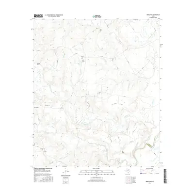
2016 Map of Middleton
USGS Topo · Published 2016About this map
Middleton anchors this pocket of east Texas where the borders of Leon and Houston counties meet at the Trinity River. The landscape is defined by a dense network of tributaries including Lower Keechi Cr, Boggy Creek, and Caney Cr which drain into the river bottomlands. Numerous family and community burial grounds, such as Spillerville Cem, New Salem Cem, and Holleman Cem, are scattered throughout the countryside, offering significant points of interest for genealogists tracing early settlers. Private aviation is represented by the Moore Ranch Airport, located near Taylor Lake. The transition from upland ridges like Red Oak Hollow to the creek flats reflects the traditional agricultural and ranching patterns of the region, connected by a web of county roads and family routes like Largaet Heirs Family Rd.
Find a feature on this map
59 named features on this map. Tap any name to fly to it.
Don’t see what you’re looking for? This feature index may not catch every label — zoom into the map to look around manually.
Map Details
Editions of this 2016 Middleton Map
This is the sole edition of this map. No revisions or reprints were ever made.
Other maps of this area

1953 · Palestine
USGS Topo · 1:250,000

1957 · Palestine
USGS Topo · 1:250,000

1964 · Sand Ridge
USGS Topo · 1:24,000

1964 · Austonio
USGS Topo · 1:24,000

1964 · Centerville
USGS Topo · 1:24,000

1964 · Eunice
USGS Topo · 1:24,000

1964 · Middleton
USGS Topo · 1:24,000

1964 · Halls Bluff
USGS Topo · 1:24,000

1964 · Leona
USGS Topo · 1:24,000
1964 · Elwood
USGS Topo · 1:24,000