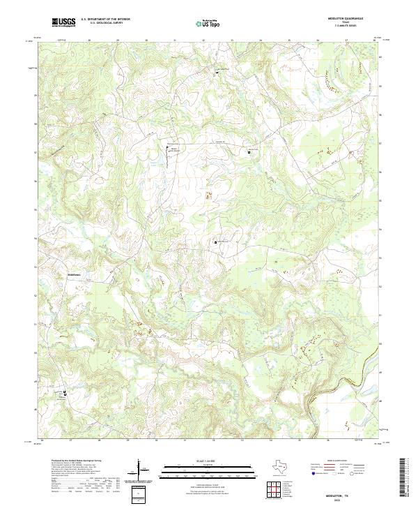
2022 Map of Middleton
USGS Topo · Published 2022About this map
Middleton and Spillerville anchor this part of East Texas, where the landscape is defined by the winding course of the Trinity River forming the boundary between Leon and Houston counties. The region is heavily marked by small family and community burial grounds, including the New Salem Cem, Holleman Cem, and Pleasant Grove Cem, which serve as vital landmarks for local genealogical research. Aviation history is noted by the presence of the Moore Ranch Airport located just south of Alabama Rd. The terrain is a complex network of creeks and hollows, such as Red Oak Hollow and Lower Keechi Cr, which drain into the river bottomlands. Numerous private and county roads, like Largent Heirs Family Rd, hint at the long-standing land ownership patterns that have shaped this rural corridor over decades.
Find a feature on this map
56 named features on this map. Tap any name to fly to it.
Don’t see what you’re looking for? This feature index may not catch every label — zoom into the map to look around manually.
Map Details
Editions of this 2022 Middleton Map
This is the sole edition of this map. No revisions or reprints were ever made.
Other maps of this area

1953 · Palestine
USGS Topo · 1:250,000

1957 · Palestine
USGS Topo · 1:250,000

1964 · Sand Ridge
USGS Topo · 1:24,000

1964 · Austonio
USGS Topo · 1:24,000

1964 · Centerville
USGS Topo · 1:24,000

1964 · Eunice
USGS Topo · 1:24,000

1964 · Middleton
USGS Topo · 1:24,000

1964 · Halls Bluff
USGS Topo · 1:24,000

1964 · Leona
USGS Topo · 1:24,000
1964 · Elwood
USGS Topo · 1:24,000