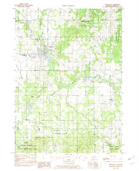
1982 Map of Middleville
USGS Topo · Published 1982About this map
The Thornapple River winds through the heart of this Barry County landscape, anchoring the village of Middleville and the smaller settlement of Irving. In the early 1980s, this area reflects a balance between rural development and expansive conservation efforts, with the Middleville State Game Area and Barry State Game Area protecting significant wetlands and forests. Educational history is visible through the presence of the Middleville Academy and the Thornapple-Kellogg High Sch.
Find a feature on this map
32 named features on this map. Tap any name to fly to it.
Don’t see what you’re looking for? This feature index may not catch every label — zoom into the map to look around manually.
Map Details
Editions of this 1982 Middleville Map
2 editions found
Other maps of this area

1914 · Grand Rapids
USGS Topo · 1:62,500

1918 · Lowell
USGS Topo · 1:62,500

1943 · Grand Rapids
USGS Topo · 1:62,500

1943 · Lowell
USGS Topo · 1:62,500

1951 · Hastings
USGS Topo · 1:62,500

1958 · Grand Rapids
USGS Topo · 1:250,000

1959 · Wayland
USGS Topo · 1:62,500

1961 · Grand Rapids
USGS Topo · 1:250,000

1962 · Grand Rapids
USGS Topo · 1:250,000
1967 · Caledonia
USGS Topo · 1:24,000