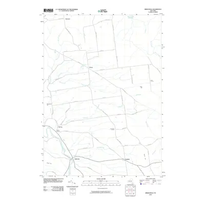
2010 Map of Middleville
USGS Topo · Published 2010About this map
Middleville sits at the junction of West Canada Creek and Maltanner Creek, serving as a focal point for the southern valley landscape of Herkimer County. This 2010 survey illustrates the rural transition from these narrow river valleys to the elevated plateaus where settlements like Norway and Fairfield were established. A network of early thoroughfares such as Military Rd and Hurricane Rd connects these scattered hamlets, tracing a pattern of land use that has persisted for generations. Genealogists and local historians can locate several historic burial sites, including the Hardscrabble Cemetery and Sweet Cemetery, alongside distinctive geographical landmarks like Barto Hill and Dairy Hill. The presence of smaller locales like Old City and Welch Corners highlights the enduring character of these rural New York crossroads.
Find a feature on this map
53 named features on this map. Tap any name to fly to it.
Don’t see what you’re looking for? This feature index may not catch every label — zoom into the map to look around manually.
Map Details
Editions of this 2010 Middleville Map
This is the sole edition of this map. No revisions or reprints were ever made.
Other maps of this area

1897 · Remsen
USGS Topo · 1:62,500

1898 · Utica
USGS Topo · 1:62,500

1900 · Little Falls
USGS Topo · 1:62,500

1900 · Utica
USGS Topo · 1:62,500

1900 · Remsen
USGS Topo · 1:62,500

1900 · Wilmurt
USGS Topo · 1:62,500

1902 · Wilmurt
USGS Topo · 1:62,500

1903 · Little Falls
USGS Topo · 1:62,500

1939 · Little Falls
USGS Topo · 1:62,500

1943 · Newport
USGS Topo · 1:24,000