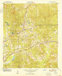
1949 Map of Midland
USGS Topo · Published 1949About this map
Midland stands at the junction of rail and road just north of the Fort Benning Military Reservation, a landscape defined by the convergence of the Southern and Central of Georgia railroads. This late 1940s survey reveals a rural territory transitioning into a strategic military corridor, where small settlements like Flat Rock and Schatulga are linked by winding creek systems including Bull Creek and Upatoi Creek.
Find a feature on this map
20 named features on this map. Tap any name to fly to it.
Don’t see what you’re looking for? This feature index may not catch every label — zoom into the map to look around manually.
Map Details
Editions of this 1949 Midland Map
2 editions found
Other maps of this area

1907 · Talbotton
USGS Topo · 1:125,000

1908 · Columbus
USGS Topo · 1:62,500

1929 · Columbus
USGS Topo · 1:48,000

1947 · Columbus
USGS Topo · 1:62,500

1949 · Midland
USGS Topo · 1:24,000

1949 · Upatoi
USGS Topo · 1:24,000

1949 · Ochillee
USGS Topo · 1:24,000

1949 · Buena Vista NW
USGS Topo · 1:24,000

1949 · Columbus
USGS Topo · 1:24,000

1950 · Fortson
USGS Topo · 1:24,000