
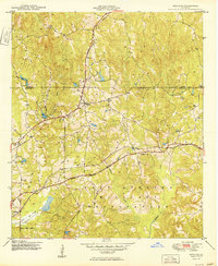
1949 Map of Midland
USGS Topo · Published 1949About this map
Midland serves as a central hub on this post-war landscape, where the Southern railroad line cuts through the heart of the terrain. The southern half of the quadrangle is dominated by the northern reaches of the Fort Benning Military Reservation, its boundary clearly marked as it follows the course of Dozier Creek. Small settlements like Flat Rock and Schatulga are situated along the rail lines, reflecting a community structure tied closely to the transportation networks of the era. Numerous unnamed Cemeteries dot the landscape near farmsteads and rural roads, providing vital clues for genealogical research. The drainage patterns of Bull Creek and Randall Creek define the local topography, while the prominent height of Lookout offers a distinct vantage point over the converging rail corridors of the Central of Georgia and Southern lines.
Find a feature on this map
15 named features on this map. Tap any name to fly to it.
Don’t see what you’re looking for? This feature index may not catch every label — zoom into the map to look around manually.
Map Details
Editions of this 1949 Midland Map
2 editions found
Other maps of this area

1907 · Talbotton
USGS Topo · 1:125,000

1908 · Columbus
USGS Topo · 1:62,500

1929 · Columbus
USGS Topo · 1:48,000

1947 · Columbus
USGS Topo · 1:62,500

1949 · Upatoi
USGS Topo · 1:24,000

1949 · Ochillee
USGS Topo · 1:24,000

1949 · Buena Vista NW
USGS Topo · 1:24,000

1949 · Columbus
USGS Topo · 1:24,000

1950 · Fortson
USGS Topo · 1:24,000

1950 · Mulberry Grove
USGS Topo · 1:24,000