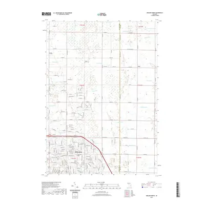
2019 Map of Midland North
USGS Topo · Published 2019About this map
Midland serves as the focal point of this 2019 survey, illustrating the modern residential and educational footprint of the city north of its core. The presence of Delta College Midland Center and the Old Calvary Cem highlights the area's ongoing community role. Moving north, the landscape transitions into the rural townships of Larkin and Duel, where a complex network of agricultural drainage systems, such as Waldo Drain and Siebert Drain, manage the low-lying terrain typical of this portion of Michigan.
Find a feature on this map
127 named features on this map. Tap any name to fly to it.
Don’t see what you’re looking for? This feature index may not catch every label — zoom into the map to look around manually.
Map Details
Editions of this 2019 Midland North Map
This is the sole edition of this map. No revisions or reprints were ever made.
Other maps of this area

1934 · Sanford
USGS Topo · 1:62,500

1936 · Sanford
USGS Topo · 1:62,500

1954 · Midland
USGS Topo · 1:250,000

1958 · Midland
USGS Topo · 1:250,000

1959 · Midland
USGS Topo · 1:250,000

1962 · Willard
USGS Topo · 1:24,000

1962 · Midland South
USGS Topo · 1:24,000

1962 · Midland North
USGS Topo · 1:24,000
1962 · Auburn
USGS Topo · 1:24,000

1966 · Midland
USGS Topo · 1:250,000