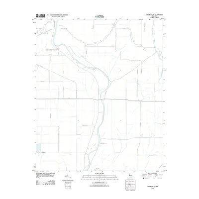
2012 Map of Midnight NW
USGS Topo · Published 2012About this map
The Big Sunflower River winds prominently through this section of the Mississippi Delta, defining the drainage patterns and historical development of rural Washington County. This survey highlights an agricultural landscape dictated by the alluvial topography, where the water levels of the Bogue Phalia and Beasley Bayou interact with a grid of country roads. The distribution of infrastructure, including Avon-Darlove Rd and Tribbett Rd, follows the higher ground near the riverbanks. Farther south, Mills Bayou cuts through the lowlands, illustrating the complex hydrology of the region. This 2012 record captures the area's modern land use while preserving the legacy of family-named landmarks and local connections like Cole Lake Rd and Broad Lake Rd that have long served this farming community.
Find a feature on this map
38 named features on this map. Tap any name to fly to it.
Don’t see what you’re looking for? This feature index may not catch every label — zoom into the map to look around manually.
Map Details
Editions of this 2012 Midnight NW Map
This is the sole edition of this map. No revisions or reprints were ever made.
Other maps of this area

1939 · Tralake
USGS Topo · 1:62,500

1939 · Swan Lake
USGS Topo · 1:62,500

1940 · Auter
USGS Topo · 1:62,500

1940 · Baird
USGS Topo · 1:62,500

1953 · Greenwood
USGS Topo · 1:250,000

1956 · Greenwood
USGS Topo · 1:250,000
1965 · Richey
USGS Topo · 1:24,000
1965 · Midnight
USGS Topo · 1:24,000

1965 · Inverness
USGS Topo · 1:24,000

1965 · Kinlock
USGS Topo · 1:24,000