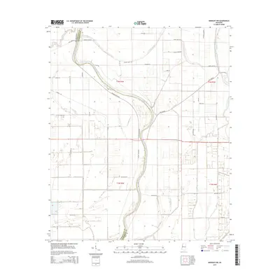
2015 Map of Midnight NW
USGS Topo · Published 2015About this map
The Big Sunflower River meanders through this portion of the Yazoo-Mississippi Delta, defining a landscape shaped by ancient alluvial paths. The complex drainage network of the region is evident through the winding courses of Beasley Bayou, Mills Bayou, and the Bogue Phalia, which intersect the agricultural grid. This survey illustrates the relationship between the natural waterways and the human-built infrastructure that has developed to manage the fertile lowlands. Local transport is represented by a dense network of country roads named for early settlers and topographical features, such as Avon-Darlove Rd, Martin Lake Rd, and Cole Lake Rd. The map also captures the political boundary between Washington and Humphreys counties as it follows the historical path of the river.
Find a feature on this map
34 named features on this map. Tap any name to fly to it.
Don’t see what you’re looking for? This feature index may not catch every label — zoom into the map to look around manually.
Map Details
Editions of this 2015 Midnight NW Map
This is the sole edition of this map. No revisions or reprints were ever made.
Other maps of this area

1939 · Tralake
USGS Topo · 1:62,500

1939 · Swan Lake
USGS Topo · 1:62,500

1940 · Auter
USGS Topo · 1:62,500

1940 · Baird
USGS Topo · 1:62,500

1953 · Greenwood
USGS Topo · 1:250,000

1956 · Greenwood
USGS Topo · 1:250,000
1965 · Richey
USGS Topo · 1:24,000
1965 · Midnight
USGS Topo · 1:24,000

1965 · Inverness
USGS Topo · 1:24,000

1965 · Kinlock
USGS Topo · 1:24,000