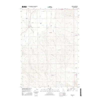
2017 Map of Midvale
USGS Topo · Published 2017About this map
Midvale and the surrounding ranching country of Middle Valley center this 2017 topographic survey of Washington County. The landscape is defined by the hydrologic network of the Weiser River valley, where the Middle Valley Ditch and several creeks including Beaver Cr and Keithly Cr supported agricultural operations. To the south and east, the terrain rises toward significant landmarks such as Star Butte and Dutch Flat, while water resources are anchored by the Little Crane Creek Reservoir and the larger Crane Creek Reservoir at the southeastern corner. Rural life is traced through established family and access roads like Happy Hollow Rd and Louie Fave Rd, along with the Eastside Cem situated east of the main settlement. The map illustrates a contemporary view of this interior Idaho valley, highlighting the persistent balance between irrigation-fed bottomlands and the high, arid rangelands of Shoe Peg Valley.
Find a feature on this map
42 named features on this map. Tap any name to fly to it.
Don’t see what you’re looking for? This feature index may not catch every label — zoom into the map to look around manually.
Map Details
Editions of this 2017 Midvale Map
This is the sole edition of this map. No revisions or reprints were ever made.
Other maps of this area

1897 · Weiser
USGS Topo · 1:125,000

1953 · Mann Creek
USGS Topo · 1:62,500

1955 · Baker
USGS Topo · 1:250,000

1957 · Cambridge
USGS Topo · 1:62,500

1957 · Crane Creek Reservoir
USGS Topo · 1:62,500

1957 · Sturgill Peak
USGS Topo · 1:62,500

1959 · Baker
USGS Topo · 1:250,000

1980 · McCall
USGS Topo · 1:100,000

1980 · Weiser
USGS Topo · 1:100,000
1986 · Crane Creek Reservoir
USGS Topo · 1:24,000