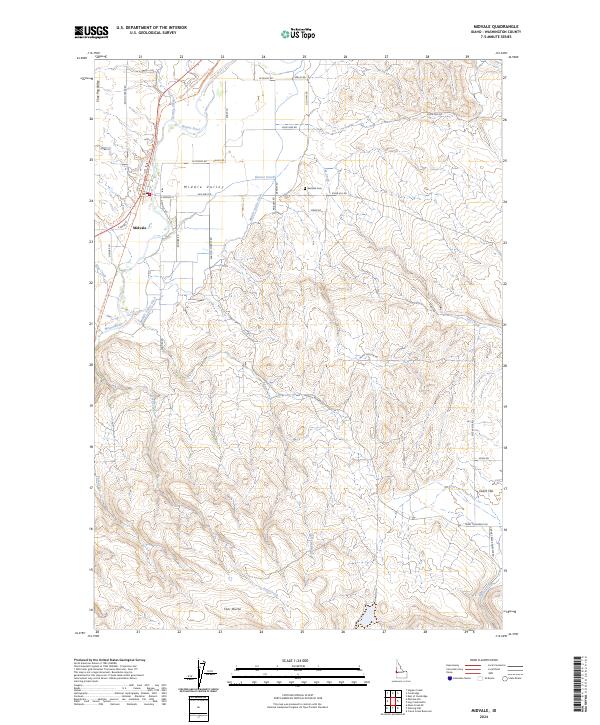
2024 Map of Midvale
USGS Topo · Published 2024About this map
Midvale serves as the central hub of this agricultural landscape in Washington County, Idaho, where the Weiser River flows through the fertile Middle Valley. The area is defined by a sophisticated water management system, including the Middle Valley Ditch, which supports the local farming economy. Transportation routes like Old Hwy Rd and the Weiser River National Recreation Trail trace the valley floor, connecting the community to landmarks such as the Eastside Cemetery. To the south and east, the terrain rises toward prominent elevations like Star Butte and the broad expanse of Dutch Flat. Dozens of local roads, including Farm to Market Rd and Happy Hollow Rd, provide a detailed record of the rural property divisions and settlement patterns that characterize this region of the Inland Northwest.
Find a feature on this map
43 named features on this map. Tap any name to fly to it.
Don’t see what you’re looking for? This feature index may not catch every label — zoom into the map to look around manually.
Map Details
Editions of this 2024 Midvale Map
This is the sole edition of this map. No revisions or reprints were ever made.
Other maps of this area

1897 · Weiser
USGS Topo · 1:125,000

1953 · Mann Creek
USGS Topo · 1:62,500

1955 · Baker
USGS Topo · 1:250,000

1957 · Cambridge
USGS Topo · 1:62,500

1957 · Crane Creek Reservoir
USGS Topo · 1:62,500

1957 · Sturgill Peak
USGS Topo · 1:62,500

1959 · Baker
USGS Topo · 1:250,000

1980 · McCall
USGS Topo · 1:100,000

1980 · Weiser
USGS Topo · 1:100,000
1986 · Crane Creek Reservoir
USGS Topo · 1:24,000