1966 Map of Midway
USGS Topo · Published 1967About this map
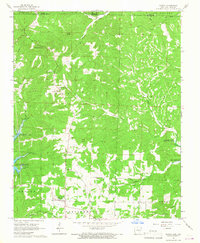
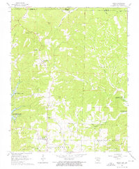
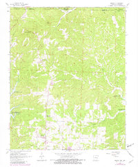
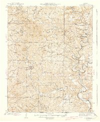
Three Brothers and Midway anchor this Ozark landscape during the mid-1960s, a period defined by the massive reservoirs of the White River system. The map documents the high-water marks for Bull Shoals Lake and Norfork Lake, showing how these impoundments transformed the deep valleys of Sister Creek and Howard Creek into sprawling fingers of water. Local history is preserved in the numerous family and community landmarks, including Three Brothers Church and a network of burial grounds like Oakland Cemetery and Conley Cemetery. The terrain is marked by distinctive elevations such as Negro Knob and Promise Land Ridge, while the presence of a Landing Strip and several Gravel Pits reflects the area's mid-century infrastructure and resource extraction. Significant for genealogists, the map also identifies scattered fords and springs along Pigeon Creek and Walker Creek.
Find a feature on this map
38 named features on this map. Tap any name to fly to it.
Don’t see what you’re looking for? This feature index may not catch every label — zoom into the map to look around manually.
Map Details
Editions of this 1966 Midway Map
3 editions found
Other maps of this area

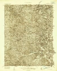
1890 · Mountain Home
USGS Topo · 1:125,000

1891 · Mountain Home
USGS Topo · 1:125,000

1893 · Yellville
USGS Topo · 1:125,000

1894 · Mountain Home
USGS Topo · 1:125,000

1903 · Yellville
USGS Topo · 1:125,000

1905 · Yellville
USGS Topo · 1:125,000

1929 · Yellville
USGS Topo · 1:125,000
1934 · Gainesville
USGS Topo · 1:48,000

1936 · Thornfield
USGS Topo · 1:48,000
1940 · Gainesville
USGS Topo · 1:62,500