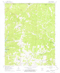
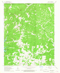
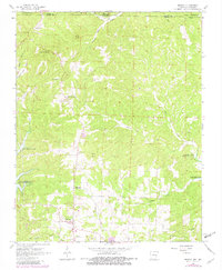
1966 Map of Midway
USGS Topo · Published 1976About this map
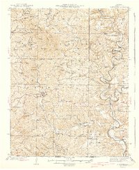
The borderlands of Ozark County and Baxter County emerge in the mid-1960s as a landscape defined by the expansive waters of Bull Shoals Lake and Norfork Lake. The small community of Three Brothers serves as a central hub, surrounded by family landmarks and local institutions like the Three Brothers Ch and Three Brothers Cem. To the south, Midway and the settlement of Arkawana mark the transition toward more developed areas, while the terrain is punctuated by distinctive rises such as Negro Knob and Bald Dave. The map records an economy of local resource extraction, evidenced by several Gravel Pits, a Quarry, and the Pigeon Mine near the banks of Little Pigeon Creek. A Landing Strip near the lakefront indicates the growing importance of regional aerial access during this era of postwar expansion.
Find a feature on this map
40 named features on this map. Tap any name to fly to it.
Don’t see what you’re looking for? This feature index may not catch every label — zoom into the map to look around manually.
Map Details
Editions of this 1966 Midway Map
3 editions found
Other maps of this area

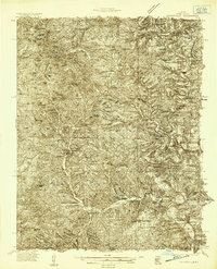
1890 · Mountain Home
USGS Topo · 1:125,000

1891 · Mountain Home
USGS Topo · 1:125,000

1893 · Yellville
USGS Topo · 1:125,000

1894 · Mountain Home
USGS Topo · 1:125,000

1903 · Yellville
USGS Topo · 1:125,000

1905 · Yellville
USGS Topo · 1:125,000

1929 · Yellville
USGS Topo · 1:125,000
1934 · Gainesville
USGS Topo · 1:48,000

1936 · Thornfield
USGS Topo · 1:48,000
1940 · Gainesville
USGS Topo · 1:62,500