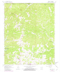
1966 Map of Midway
USGS Topo · Published 1982About this map
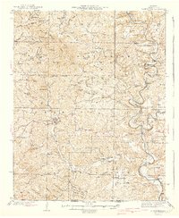
Midway and the surrounding rural landscape of the Ozark and Baxter county line are captured here during a period of transition in the mid-1960s, with updates reflecting the early 1980s. The geography is defined by the high-water marks of Bull Shoals Lake and Norfork Lake, which flank the central ridges. These artificial reservoirs altered the local drainage, affecting creeks such as Howard Creek and Pigeon Creek.
Find a feature on this map
34 named features on this map. Tap any name to fly to it.
Don’t see what you’re looking for? This feature index may not catch every label — zoom into the map to look around manually.
Map Details
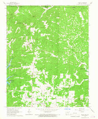
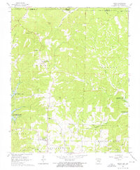
Editions of this 1966 Midway Map
3 editions found
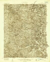
Other maps of this area

1890 · Mountain Home
USGS Topo · 1:125,000

1891 · Mountain Home
USGS Topo · 1:125,000

1893 · Yellville
USGS Topo · 1:125,000

1894 · Mountain Home
USGS Topo · 1:125,000

1903 · Yellville
USGS Topo · 1:125,000

1905 · Yellville
USGS Topo · 1:125,000

1929 · Yellville
USGS Topo · 1:125,000
1934 · Gainesville
USGS Topo · 1:48,000

1936 · Thornfield
USGS Topo · 1:48,000
1940 · Gainesville
USGS Topo · 1:62,500