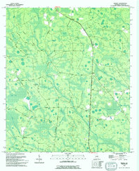
1994 Map of Midway
USGS Topo · Published 1994About this map
Midway and Magnolia anchor this Clinch County landscape, where the southern Georgia terrain is defined by an intricate network of wetlands known as bays. Names like Foreman Bay, Beede Bay, and Salt Road Bay mark these low-lying areas, which are interspersed with higher ground such as Knight Island and Crews Island. The map reveals a rural infrastructure of family-named roads and remote burial sites, including Griffis Cem and Chauncey Cem, which offer significant value for genealogical research in this sparsely populated region.
Find a feature on this map
35 named features on this map. Tap any name to fly to it.
Don’t see what you’re looking for? This feature index may not catch every label — zoom into the map to look around manually.
Map Details
Editions of this 1994 Midway Map
This is the sole edition of this map. No revisions or reprints were ever made.
Other maps of this area

1953 · Waycross
USGS Topo · 1:250,000

1954 · Valdosta
USGS Topo · 1:250,000

1958 · Valdosta
USGS Topo · 1:250,000

1958 · Waycross
USGS Topo · 1:250,000

1959 · Valdosta
USGS Topo · 1:250,000

1967 · Spooner
USGS Topo · 1:24,000

1967 · Colon
USGS Topo · 1:24,000

1968 · Homerville East
USGS Topo · 1:24,000

1968 · Midway
USGS Topo · 1:24,000

1968 · Headlight
USGS Topo · 1:24,000