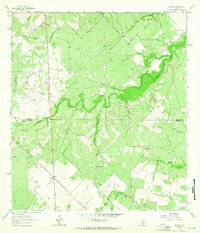
1963 Map of Midway
USGS Topo · Published 1965About this map
The Ramirena Oil Field and Hinnant Oil Field define the industrial footprint of this South Texas landscape, where energy extraction meets traditional ranching. In the early 1960s, the terrain was dotted with active drilling sites, shown through labels like Stehle Oil Field and scattered drill holes and oil wells. The small settlement of Midway serves as a central point in an area otherwise defined by watercourses like Lagarto Creek and Julian Creek.
Find a feature on this map
21 named features on this map. Tap any name to fly to it.
Don’t see what you’re looking for? This feature index may not catch every label — zoom into the map to look around manually.
Map Details
Editions of this 1963 Midway Map
2 editions found
Other maps of this area

1920 · Mikeska
USGS Topo · 1:125,000

1920 · San Diego
USGS Topo · 1:62,500

1925 · Mathis No. 2
USGS Topo · 1:48,000

1925 · Mathis No. 3
USGS Topo · 1:48,000

1927 · Mathis
USGS Topo · 1:62,500

1950 · Corpus Christi
USGS Topo · 1:250,000

1953 · Crystal City
USGS Topo · 1:250,000

1953 · Beeville
USGS Topo · 1:250,000

1954 · Orange Grove
USGS Topo · 1:62,500

1954 · Mathis
USGS Topo · 1:62,500