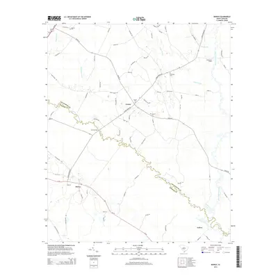
2014 Map of Midway
USGS Topo · Published 2014About this map
The South Fork Edisto River snakes through this portion of the South Carolina Lowcountry, defining much of the boundary between Orangeburg and Bamberg counties. Near the river's winding path, small historic communities like Canaan and Midway are anchored by local landmarks such as Canaan Cem and Emanuel Cem. The landscape is a network of water and drainage, featuring the Isaac Jennings Canal and extensive swamp systems like Snake Swamp, Cooper Swamp, and Dry Swamp.
Find a feature on this map
74 named features on this map. Tap any name to fly to it.
Don’t see what you’re looking for? This feature index may not catch every label — zoom into the map to look around manually.
Map Details
Editions of this 2014 Midway Map
This is the sole edition of this map. No revisions or reprints were ever made.
Other maps of this area

1919 · Olar
USGS Topo · 1:62,500

1919 · Bamberg
USGS Topo · 1:48,000

1919 · Lodge
USGS Topo · 1:62,500

1920 · Lodge
USGS Topo · 1:48,000

1920 · Bamberg
USGS Topo · 1:62,500

1920 · Orangeburg
USGS Topo · 1:48,000

1921 · Orangeburg
USGS Topo · 1:62,500

1921 · Lodge
USGS Topo · 1:62,500

1943 · Olar
USGS Topo · 1:62,500

1943 · Lodge
USGS Topo · 1:62,500