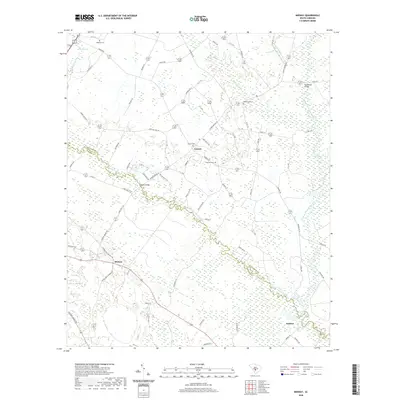
2020 Map of Midway
USGS Topo · Published 2020About this map
Midway and Canaan anchor a landscape defined by the convergence of the South Fork Edisto River and the North Fork Edisto River. This corridor, straddling the Orangeburg and Bamberg county line, reveals a complex network of wetland features including Snake Swamp, Copper Swamp, and Dry Swamp. The settlement pattern follows higher ground between these watercourses, with several historic burial grounds such as Oakland Cem, Bethlehem Cem, and Canaan Cem marking established community sites. To the southeast, the settlement of Embree sits near the river's bend, while Cannon Bridge serves as a key crossing point. The terrain is further characterized by large basins like Gantts Bay and Piney Bay, illustrating the low-lying, hydrologically active nature of this coastal plain region.
Find a feature on this map
67 named features on this map. Tap any name to fly to it.
Don’t see what you’re looking for? This feature index may not catch every label — zoom into the map to look around manually.
Map Details
Editions of this 2020 Midway Map
This is the sole edition of this map. No revisions or reprints were ever made.
Other maps of this area

1919 · Olar
USGS Topo · 1:62,500

1919 · Bamberg
USGS Topo · 1:48,000

1919 · Lodge
USGS Topo · 1:62,500

1920 · Lodge
USGS Topo · 1:48,000

1920 · Bamberg
USGS Topo · 1:62,500

1920 · Orangeburg
USGS Topo · 1:48,000

1921 · Orangeburg
USGS Topo · 1:62,500

1921 · Lodge
USGS Topo · 1:62,500

1943 · Olar
USGS Topo · 1:62,500

1943 · Lodge
USGS Topo · 1:62,500