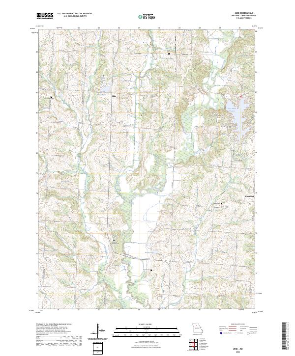
2023 Map of Mike
USGS Topo · Published 2023About this map
Mike and Musselfork anchor this agrarian landscape in Chariton County, where the terrain is defined by the winding tributaries of the Missouri River watershed. The map reveals a high concentration of small, family-associated burial grounds such as Mount Pleasant Cem, Welch Cem, and Brooks Cem, highlighting the deep-rooted genealogical heritage of this rural community. Notable water features like Mussel Fork and Long Branch bisect the patchwork of farmsteads and conservation lands under the Farm Service Agency Interest of Missouri. Modern residential developments are evident near the shores of Lake Nehai Tonayea and Pleasure Hills Estates Lake, contrasting with the more traditional grid of county roads like Saint Joseph Ave and Pee Dee Rd that have served the region for generations.
Find a feature on this map
71 named features on this map. Tap any name to fly to it.
Don’t see what you’re looking for? This feature index may not catch every label — zoom into the map to look around manually.
Map Details
Editions of this 2023 Mike Map
This is the sole edition of this map. No revisions or reprints were ever made.
Other maps of this area

1890 · Glasgow
USGS Topo · 1:125,000

1890 · Marshall
USGS Topo · 1:125,000

1892 · Marshall
USGS Topo · 1:125,000

1901 · Marshall
USGS Topo · 1:125,000

1949 · Indian Grove
USGS Topo · 1:24,000

1949 · Rothville
USGS Topo · 1:24,000

1950 · Rothville
USGS Topo · 1:24,000

1951 · Brunswick East
USGS Topo · 1:24,000

1953 · Moberly
USGS Topo · 1:250,000

1953 · Marceline
USGS Topo · 1:24,000