
1958 Map of Milan
USGS Topo · Published 1959About this map
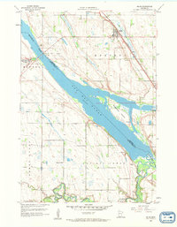
The Minnesota River valley dominates this western Minnesota landscape, serving as the border between Chippewa and Lac qui Parle counties. The village of Milan sits in the northeast, positioned along the Chicago Milwaukee St Paul and Pacific railroad line near the historic Kviteseid Cem. To the southwest, the wide expanse of Lac Qui Parle fills the valley floor, broken by Rosemoen Island and joined by the Lac qui Parle River as it flows from the south.
Find a feature on this map
20 named features on this map. Tap any name to fly to it.
Don’t see what you’re looking for? This feature index may not catch every label — zoom into the map to look around manually.
Map Details
Editions of this 1958 Milan Map
2 editions found
Other maps of this area

1953 · Milbank
USGS Topo · 1:250,000

1953 · Watertown
USGS Topo · 1:250,000

1953 · New Ulm
USGS Topo · 1:250,000

1953 · Saint Cloud
USGS Topo · 1:250,000

1957 · Saint Cloud
USGS Topo · 1:250,000

1957 · New Ulm
USGS Topo · 1:250,000

1958 · New Ulm
USGS Topo · 1:250,000

1958 · Milbank
USGS Topo · 1:250,000

1958 · Watertown
USGS Topo · 1:250,000

1958 · Saint Cloud
USGS Topo · 1:250,000