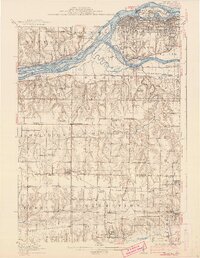
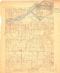
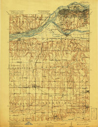
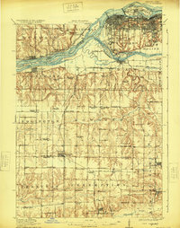
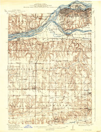
1912 Map of Milan
USGS Topo · Published 1938About this map
The Mississippi River and Rock River converge at the northern edge of this landscape, defining the industrial and transport hub around Milan, South Rock Island, and Moline. At the center of the river activity lies the U S Arsenal on Rock Island, while smaller islands like Vandruff Island and Pettifer Island divide the complex river channels. South of the river valleys, the terrain shifts into the dissected uplands of Rock Island Co and Mercer Co, where a dense network of country schools and rural townships like Edgington and Preemption reveal a well-established agricultural community.
Find a feature on this map
94 named features on this map. Tap any name to fly to it.
Don’t see what you’re looking for? This feature index may not catch every label — zoom into the map to look around manually.
Map Details
Editions of this 1912 Milan Map
7 editions found
Other maps of this area

1890 · Durant
USGS Topo · 1:62,500

1891 · Davenport
USGS Topo · 1:62,500

1892 · Leclaire
USGS Topo · 1:62,500

1893 · Leclaire
USGS Topo · 1:62,500

1894 · Durant
USGS Topo · 1:62,500

1894 · Davenport
USGS Topo · 1:62,500

1899 · Clinton
USGS Topo · 1:125,000

1901 · Rock Island
USGS Topo · 1:125,000

1910 · Rock Island
USGS Topo · 1:125,000

1912 · Milan
USGS Topo · 1:62,500