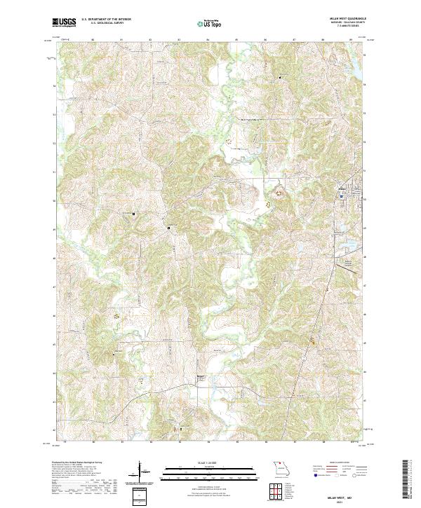
2021 Map of Milan West
USGS Topo · Published 2021About this map
Milan serves as the focal point of this western Sullivan County survey, with the Sullivan County Courthouse anchoring the town's central grid. The landscape is defined by the winding course of Locust Creek and its tributary, W Locust Cr, which meander through a series of north-south ridges. This area preserves a significant record of early local families through a high density of rural burial grounds, including Wilhite Cem, Shatto Cem, Glaze Cem, and Lovell Cem. To the south, the settlement of Reger sits along the road network near Henry Cem. Water management is prominent in the eastern section, evidenced by the New Milan Reservoir, Shatto Lake, and Detwiler Lake. Aviation infrastructure is represented by the Bogard-Cowgill Airport, located just south of the main Milan area. The intricate network of local roads like Peach Rd, Orchard Rd, and Club Dr suggests a landscape of small agricultural holdings and rural residences characteristic of northern Missouri.
Find a feature on this map
66 named features on this map. Tap any name to fly to it.
Don’t see what you’re looking for? This feature index may not catch every label — zoom into the map to look around manually.
Map Details
Editions of this 2021 Milan West Map
This is the sole edition of this map. No revisions or reprints were ever made.
Other maps of this area

1946 · Galt
USGS Topo · 1:62,500

1949 · Galt
USGS Topo · 1:62,500

1954 · Centerville
USGS Topo · 1:250,000

1957 · Centerville
USGS Topo · 1:250,000

1958 · Centerville
USGS Topo · 1:250,000
1964 · Milan SE
USGS Topo · 1:24,000

1964 · Harris
USGS Topo · 1:24,000
1964 · Browning
USGS Topo · 1:24,000

1964 · Milan West
USGS Topo · 1:24,000
1964 · Milan East
USGS Topo · 1:24,000