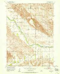
1951 Map of Milburn
USGS Topo · Published 1953About this map
The Middle Loup River carves a diagonal path through this Custer County landscape, dividing the intricate canyon systems of the north from the rolling upland tables to the south. In the early 1950s, this area centered on the small settlement of Milburn, with rural life anchored by local landmarks such as Columbia Table Sch and Bell Sch. The mapping reflects a post-war era of Missouri River Basin development, noting precise elevations and irrigation potential across townships like Milburn and Victoria.
Find a feature on this map
19 named features on this map. Tap any name to fly to it.
Don’t see what you’re looking for? This feature index may not catch every label — zoom into the map to look around manually.
Map Details
Editions of this 1951 Milburn Map
3 editions found
Other maps of this area

1951 · Lillian
USGS Topo · 1:24,000

1951 · Anselmo
USGS Topo · 1:24,000

1951 · Walworth
USGS Topo · 1:24,000

1951 · Anselmo NE
USGS Topo · 1:24,000

1951 · Round Valley
USGS Topo · 1:24,000

1951 · Milburn
USGS Topo · 1:24,000

1952 · Almeria SW
USGS Topo · 1:24,000

1952 · Brewster SE
USGS Topo · 1:24,000

1952 · Almeria
USGS Topo · 1:24,000

1955 · Broken Bow
USGS Topo · 1:250,000