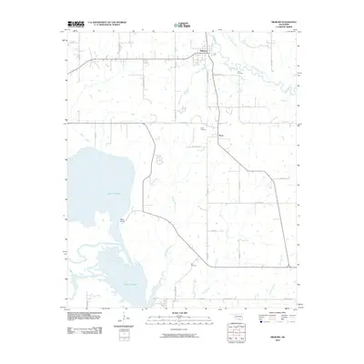
2010 Map of Milburn
USGS Topo · Published 2010About this map
Milburn serves as the northern hub of this Johnston County landscape, where the Blue River and Little Sandy Creek converge amidst a network of rural section roads. The terrain transitions from the river valley in the north to the sprawling reaches of Lake Texoma in the southwest, featuring the prominent Nida Point. Local history is anchored by several long-standing community centers and family landmarks, including the settlements of Emet and Nida.
Find a feature on this map
37 named features on this map. Tap any name to fly to it.
Don’t see what you’re looking for? This feature index may not catch every label — zoom into the map to look around manually.
Map Details
Editions of this 2010 Milburn Map
This is the sole edition of this map. No revisions or reprints were ever made.
Other maps of this area

1899 · Atoka
USGS Topo · 1:125,000

1900 · Atoka
USGS Topo · 1:125,000

1901 · Tishomingo
USGS Topo · 1:125,000

1957 · Ardmore
USGS Topo · 1:250,000

1963 · Ardmore
USGS Topo · 1:250,000
1967 · Tishomingo SW
USGS Topo · 1:24,000

1967 · Connerville SE
USGS Topo · 1:24,000

1967 · Tishomingo
USGS Topo · 1:24,000
1967 · Reagan
USGS Topo · 1:24,000
1967 · Little City
USGS Topo · 1:24,000