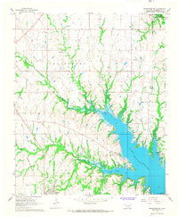
1967 Map of Tishomingo SW
USGS Topo · Published 1968About this map
Lake Texoma dominates this Marshall County landscape, showing the intricate shoreline and flooded valleys of the Red River basin in the late 1960s. The town of Kingston sits in the southwestern corner, serving as a hub for the surrounding rural districts of Willis, Taliaferro, and Odell. Industrial and transport history is prominent, with the St Louis - San Francisco railroad cutting through the terrain and the Old Railroad Grade marking a former alignment near the Madill Oil Field.
Find a feature on this map
24 named features on this map. Tap any name to fly to it.
Don’t see what you’re looking for? This feature index may not catch every label — zoom into the map to look around manually.
Map Details
Editions of this 1967 Tishomingo SW Map
2 editions found
Other maps of this area

1901 · Tishomingo
USGS Topo · 1:125,000

1901 · Denison
USGS Topo · 1:125,000

1954 · Sherman
USGS Topo · 1:250,000

1957 · Ardmore
USGS Topo · 1:250,000

1958 · Gordonville
USGS Topo · 1:62,500

1958 · Denison Dam
USGS Topo · 1:62,500

1958 · Sherman
USGS Topo · 1:250,000

1963 · Ardmore
USGS Topo · 1:250,000

1963 · Madill
USGS Topo · 1:24,000

1963 · Ravia
USGS Topo · 1:24,000