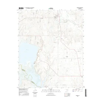
2016 Map of Milburn
USGS Topo · Published 2016About this map
Milburn serves as a focal point for this survey, situated near the confluence of Brushy Cr and the Blue River. The landscape transitions from the open stretches of Twelvemile Prairie to the northern reaches of Lake Texoma, where the Washita River enters the reservoir. This area in Johnston County is marked by several small rural settlements and homesteads that have persisted over generations.
Find a feature on this map
58 named features on this map. Tap any name to fly to it.
Don’t see what you’re looking for? This feature index may not catch every label — zoom into the map to look around manually.
Map Details
Editions of this 2016 Milburn Map
This is the sole edition of this map. No revisions or reprints were ever made.
Other maps of this area

1899 · Atoka
USGS Topo · 1:125,000

1900 · Atoka
USGS Topo · 1:125,000

1901 · Tishomingo
USGS Topo · 1:125,000

1957 · Ardmore
USGS Topo · 1:250,000

1963 · Ardmore
USGS Topo · 1:250,000
1967 · Tishomingo SW
USGS Topo · 1:24,000

1967 · Connerville SE
USGS Topo · 1:24,000

1967 · Tishomingo
USGS Topo · 1:24,000
1967 · Reagan
USGS Topo · 1:24,000
1967 · Little City
USGS Topo · 1:24,000