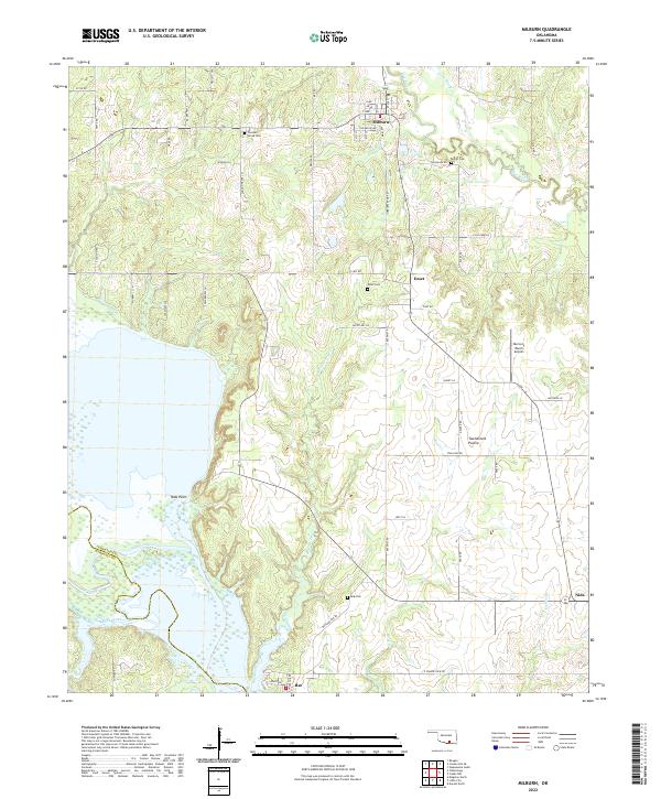
2022 Map of Milburn
USGS Topo · Published 2022About this map
Milburn serves as the primary hub in this southern Johnston County landscape, situated where Brushy Cr and the Blue River drainage define the local topography. The map illustrates a rural network of farm-to-market roads and section lines connecting the established settlements of Emet, Bee, and Nida. Genealogists will find several burial sites well-marked, including Condon Grove Cem and Harris Cem near Milburn, alongside the Emet Cem and Bee Cem further south. The southwestern portion of the sheet is dominated by the wide expanse of the Washita River, where the shoreline reaches into the Twelvemile Prairie at Nida Point. This modern survey documents the contemporary boundaries between Johnston and Marshall counties, showing how the river channel and its tributaries like Butcher Pen Cr and Rock Cr shape the land use and accessibility of the region.
Find a feature on this map
70 named features on this map. Tap any name to fly to it.
Don’t see what you’re looking for? This feature index may not catch every label — zoom into the map to look around manually.
Map Details
Editions of this 2022 Milburn Map
This is the sole edition of this map. No revisions or reprints were ever made.
Other maps of this area

1899 · Atoka
USGS Topo · 1:125,000

1900 · Atoka
USGS Topo · 1:125,000

1901 · Tishomingo
USGS Topo · 1:125,000

1957 · Ardmore
USGS Topo · 1:250,000

1963 · Ardmore
USGS Topo · 1:250,000
1967 · Tishomingo SW
USGS Topo · 1:24,000

1967 · Connerville SE
USGS Topo · 1:24,000

1967 · Tishomingo
USGS Topo · 1:24,000
1967 · Reagan
USGS Topo · 1:24,000
1967 · Little City
USGS Topo · 1:24,000