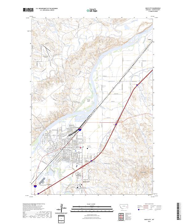
2024 Map of Miles City
USGS Topo · Published 2024About this map
Miles City serves as the focal point of this 2024 landscape, situated at the confluence of the Yellowstone River and the Tongue River. The settlement's institutional history is anchored by the Custer County Courthouse and Miles Community College, while the expansive Tongue and Yellowstone River Irrigation District Canal highlights the region's managed water network. The terrain is marked by prominent elevations like Signal Butte and Carbon Hill, with Pirogue Island situated in the center of the Yellowstone.
Find a feature on this map
155 named features on this map. Tap any name to fly to it.
Don’t see what you’re looking for? This feature index may not catch every label — zoom into the map to look around manually.
Map Details
Editions of this 2024 Miles City Map
This is the sole edition of this map. No revisions or reprints were ever made.
Other maps of this area

1953 · Miles City
USGS Topo · 1:250,000

1957 · Miles City
USGS Topo · 1:250,000

1958 · Miles City
USGS Topo · 1:250,000

1968 · Big Hill
USGS Topo · 1:24,000

1968 · Miles City
USGS Topo · 1:24,000

1968 · Lignite Creek
USGS Topo · 1:24,000

1968 · Paddy Fay Creek
USGS Topo · 1:24,000

1969 · Noble Reservoir
USGS Topo · 1:24,000
1969 · Deadman Creek
USGS Topo · 1:24,000

1969 · Kinsey
USGS Topo · 1:24,000
Featured Places
- Miles City, MT
- Tusler, MT
- Carbon Hill Trailer Court, Miles City
- Smiths Trailer Court, Miles City
- Westwood Estates, Miles City