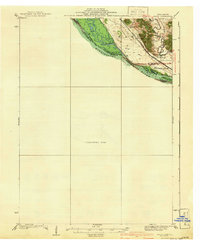
1941 Map of Miles
USGS Topo · Published 1941About this map
The Mississippi River defines the western edge of this 1935 survey, where the state boundary between Illinois and Iowa weaves through a complex system of river islands including Island No 254 and Island No 255. On the Illinois side, the Chicago Burlington and Quincy railroad follows the river's course, connecting the small settlement of Whitton to the wider region. Further south, the landscape is marked by Lost Mound and the nearby Lost Mound Sch, reflecting the local rural infrastructure of Jo Daviess and Carroll Counties before the mid-century.
Find a feature on this map
16 named features on this map. Tap any name to fly to it.
Don’t see what you’re looking for? This feature index may not catch every label — zoom into the map to look around manually.
Map Details
Editions of this 1941 Miles Map
2 editions found

Other maps of this area

1891 · DeWitt
USGS Topo · 1:62,500

1891 · Maquoketa
USGS Topo · 1:62,500

1891 · Clinton
USGS Topo · 1:62,500

1892 · Goose Lake
USGS Topo · 1:62,500

1892 · Savanna
USGS Topo · 1:62,500

1894 · Goose Lake
USGS Topo · 1:62,500

1894 · Clinton
USGS Topo · 1:62,500

1899 · Clinton
USGS Topo · 1:125,000

1901 · Peosta
USGS Topo · 1:125,000

1901 · Rock Island
USGS Topo · 1:125,000