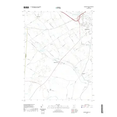
2019 Map of Milford Center
USGS Topo · Published 2019About this map
Big Darby Creek and Buck Run converge near the village of Milford Center, defining a landscape where small-town life meets a sprawling network of family and community cemeteries. The map illustrates the suburban expansion of Marysville in the northeast, where residential streets like Sherwood Ave and Timber Trails Rd contrast with the rural grid of the surrounding townships. Local history is deeply etched into the land through sites such as Saint Johns Cem and Oakdale Cem, while the western edge remains largely agricultural, punctuated by Allen Center and the wetland of Crane Swamp.
Find a feature on this map
87 named features on this map. Tap any name to fly to it.
Don’t see what you’re looking for? This feature index may not catch every label — zoom into the map to look around manually.
Map Details
Editions of this 2019 Milford Center Map
This is the sole edition of this map. No revisions or reprints were ever made.
Other maps of this area

1913 · East Liberty
USGS Topo · 1:62,500

1913 · Richwood
USGS Topo · 1:62,500

1914 · Mechanicsburg
USGS Topo · 1:62,500

1915 · Richwood
USGS Topo · 1:62,500

1915 · East Liberty
USGS Topo · 1:62,500

1916 · Mechanicsburg
USGS Topo · 1:62,500

1916 · Milford Center
USGS Topo · 1:62,500

1944 · East Liberty
USGS Topo · 1:62,500

1944 · Mechanicsburg
USGS Topo · 1:62,500

1944 · Richwood
USGS Topo · 1:62,500