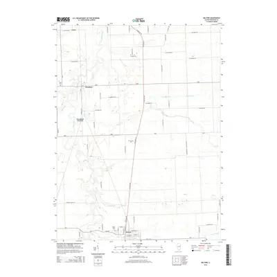
2015 Map of Milford
USGS Topo · Published 2015About this map
Milford anchors the southern portion of this landscape, where a grid of residential streets like N Chicago St and E Lyle St meet the surrounding agricultural fields of Iroquois County. The town is situated near the northern banks of Sugar Creek, a winding waterway that dominates the local drainage system alongside its tributary, Coon Cr. The region is defined by a dense network of sectional roads and the historical rail alignment passing through Woodland Junction and the community of Woodland. Genealogists will find several notable burial sites throughout the township, including Maple Grove Cem on the outskirts of Milford, as well as more isolated locations such as Vennum Cem, Belmont Cem, and Body Cem. In the northeastern quadrant, the transition from natural waterways to managed drainage is evident with the presence of Possum Trot Ditch.
Find a feature on this map
54 named features on this map. Tap any name to fly to it.
Don’t see what you’re looking for? This feature index may not catch every label — zoom into the map to look around manually.
Map Details
Editions of this 2015 Milford Map
This is the sole edition of this map. No revisions or reprints were ever made.
Other maps of this area

1935 · Watseka
USGS Topo · 1:48,000

1938 · Milford
USGS Topo · 1:48,000

1939 · Watseka
USGS Topo · 1:62,500

1939 · Cissna Park
USGS Topo · 1:62,500

1944 · Milford
USGS Topo · 1:62,500

1944 · Gilman
USGS Topo · 1:62,500

1946 · Gilman
USGS Topo · 1:62,500

1949 · Cissna Park
USGS Topo · 1:62,500

1953 · Danville
USGS Topo · 1:250,000

1955 · Danville
USGS Topo · 1:250,000