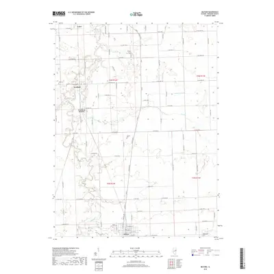
2018 Map of Milford
USGS Topo · Published 2018About this map
The village of Milford serves as the primary hub on this Iroquois County landscape, where the local street grid including E Hickory St and E Lyle St meets the agricultural hinterland. The map documents a rural environment shaped by the winding course of Sugar Creek, which meanders from the northwest toward the southeast, accompanied by tributaries like Coon Cr. Notable for genealogists are the numerous burial sites scattered across the townships, including Maple Grove Cem near the southern edge and the isolated Vennum Cem located further north. Transportation and logistics are central to the area's layout, highlighted by the rail-associated site at Woodland Junction and the small settlement of Coaler. The intersection of drainage features like Possum Trot Ditch with the section-line road network illustrates the 21st-century management of this fertile Illinois prairie land.
Find a feature on this map
38 named features on this map. Tap any name to fly to it.
Don’t see what you’re looking for? This feature index may not catch every label — zoom into the map to look around manually.
Map Details
Editions of this 2018 Milford Map
This is the sole edition of this map. No revisions or reprints were ever made.
Other maps of this area

1935 · Watseka
USGS Topo · 1:48,000

1938 · Milford
USGS Topo · 1:48,000

1939 · Watseka
USGS Topo · 1:62,500

1939 · Cissna Park
USGS Topo · 1:62,500

1944 · Milford
USGS Topo · 1:62,500

1944 · Gilman
USGS Topo · 1:62,500

1946 · Gilman
USGS Topo · 1:62,500

1949 · Cissna Park
USGS Topo · 1:62,500

1953 · Danville
USGS Topo · 1:250,000

1955 · Danville
USGS Topo · 1:250,000