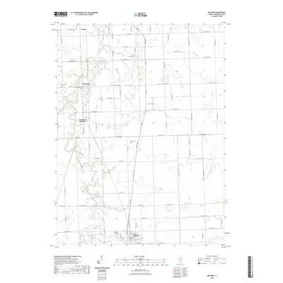
2021 Map of Milford
USGS Topo · Published 2021About this map
Milford serves as the primary hub in this portion of Iroquois County, situated along the banks of Sugar Creek. The landscape is defined by a dense grid of rural roads and drainage infrastructure like Possum Trot Ditch and Coon Cr, which support the extensive agricultural operations of the region. Moving north, the settlements of Woodland and Woodland Junction appear, alongside the small locality of Coaler near the northern boundary.
Find a feature on this map
72 named features on this map. Tap any name to fly to it.
Don’t see what you’re looking for? This feature index may not catch every label — zoom into the map to look around manually.
Map Details
Editions of this 2021 Milford Map
This is the sole edition of this map. No revisions or reprints were ever made.
Other maps of this area

1935 · Watseka
USGS Topo · 1:48,000

1938 · Milford
USGS Topo · 1:48,000

1939 · Watseka
USGS Topo · 1:62,500

1939 · Cissna Park
USGS Topo · 1:62,500

1944 · Milford
USGS Topo · 1:62,500

1944 · Gilman
USGS Topo · 1:62,500

1946 · Gilman
USGS Topo · 1:62,500

1949 · Cissna Park
USGS Topo · 1:62,500

1953 · Danville
USGS Topo · 1:250,000

1955 · Danville
USGS Topo · 1:250,000