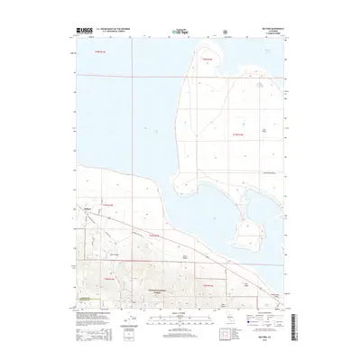
2015 Map of Milford
USGS Topo · Published 2015About this map
Milford sits at the base of the steep eastern Sierra Nevada slopes where the mountains meet the expansive Honey Lake Valley. This 2015 topographical study illustrates the transition from the dense, high-elevation terrain of the Plumas National Forest to the flat, alkaline basin of Honey Lake. The settlement is concentrated along the historic corridor of Highway 395, supported by seasonal drainages like Mill Cr. A notable feature of the lakebed is The Island, a topographic rise surrounded by the ephemeral lake surface. The map traces the winding paths of local routes such as Milford Grade Rd and Co Road 336, which navigate the deep incisions of East Canyon and Stiles Canyon. The border between Lassen and Plumas counties is clearly delineated as it traverses the ridgelines overlooking the valley floor.
Find a feature on this map
24 named features on this map. Tap any name to fly to it.
Don’t see what you’re looking for? This feature index may not catch every label — zoom into the map to look around manually.
Map Details
Editions of this 2015 Milford Map
This is the sole edition of this map. No revisions or reprints were ever made.
Other maps of this area

1886 · Honey Lake
USGS Topo · 1:250,000

1891 · Honey Lake
USGS Topo · 1:250,000

1893 · Honey Lake
USGS Topo · 1:250,000

1950 · Milford
USGS Topo · 1:62,500

1954 · Wendel
USGS Topo · 1:62,500

1954 · Litchfield
USGS Topo · 1:62,500

1954 · Doyle
USGS Topo · 1:62,500

1955 · Westwood
USGS Topo · 1:250,000

1958 · Westwood
USGS Topo · 1:250,000

1959 · Westwood
USGS Topo · 1:250,000