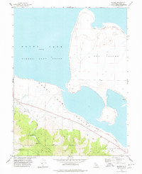
1977 Map of Milford
USGS Topo · Published 1978About this map
The northern reaches of the Diamond Mountains give way to the expansive floor of Honey Lake Valley in this late 1970s survey. The landscape is dominated by the seasonal waters and alkaline flats of Honey Lake, featuring a prominent landform known as The Island and the restricted territory of the Sierra Army Depot. Along the edge of the Plumas National Forest, the small settlement of Milford sits at the foot of the range where Mill Creek descends toward the basin. The map captures a transition between high-altitude forest and desert sink, including industrial and resource sites such as the Corona Mine and Honey Lake Mine tucked into the canyons. For genealogists and local historians, the inclusion of the Laufman Ranger Station and a solitary Grave near the forest boundary provides specific points of interest for tracing early 20th-century activity in Lassen County.
Find a feature on this map
22 named features on this map. Tap any name to fly to it.
Don’t see what you’re looking for? This feature index may not catch every label — zoom into the map to look around manually.
Map Details
Editions of this 1977 Milford Map
This is the sole edition of this map. No revisions or reprints were ever made.
Other maps of this area

1886 · Honey Lake
USGS Topo · 1:250,000

1891 · Honey Lake
USGS Topo · 1:250,000

1893 · Honey Lake
USGS Topo · 1:250,000

1950 · Milford
USGS Topo · 1:62,500

1954 · Wendel
USGS Topo · 1:62,500

1954 · Litchfield
USGS Topo · 1:62,500

1954 · Doyle
USGS Topo · 1:62,500

1955 · Westwood
USGS Topo · 1:250,000

1958 · Westwood
USGS Topo · 1:250,000

1959 · Westwood
USGS Topo · 1:250,000