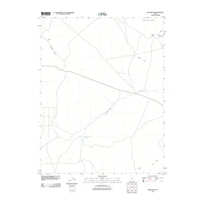
2010 Map of Milford NW
USGS Topo · Published 2010About this map
Mining operations and arid water systems define this stretch of Beaver County at the start of the 21st century. The landscape is anchored by the Beaver Lake Mountains to the north and the Star Range in the south, with numerous industrial sites reflecting the area's geological wealth. Notable extraction points including the Carbonate Mine, Beaver-Harrison Mine, and OK Mine are scattered across the terrain, connected by a network of drainage features like Carbonate Gulch and Hickory Wash. The sparse settlement of Blueacre stands near the northeastern peaks, while the hydrologic footprint of The Big Wash and The Big Wash Reservoir provides a clear view of how water is managed in this desert environment. For the local historian, the map reveals the placement of historical mining claims like the Wild Bill Mine in relation to the evolving road infrastructure of the modern era.
Find a feature on this map
11 named features on this map. Tap any name to fly to it.
Don’t see what you’re looking for? This feature index may not catch every label — zoom into the map to look around manually.
Map Details
Editions of this 2010 Milford NW Map
This is the sole edition of this map. No revisions or reprints were ever made.
Other maps of this area

1953 · Milford Flat
USGS Topo · 1:24,000

1953 · Richfield
USGS Topo · 1:250,000

1958 · Richfield
USGS Topo · 1:250,000

1958 · Milford
USGS Topo · 1:62,500

1958 · Milford
USGS Topo · 1:24,000

1959 · Frisco
USGS Topo · 1:62,500

1960 · Frisco Peak
USGS Topo · 1:62,500

1960 · Beaver Lake Mts.
USGS Topo · 1:62,500

1980 · Wah Wah Mts. South
USGS Topo · 1:100,000

1980 · Wah Wah Mts. North
USGS Topo · 1:100,000