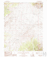
1989 Map of Milford NW
USGS Topo · Published 1989About this map
Beaver Lake Mountains dominate the northeastern corner of this western Utah landscape, where a legacy of hard-rock mining is etched into the terrain. The presence of the Carbonate Mine, Beaver-Harrison Mine, and Wild Bill Mine suggests an era of intensive extraction, with numerous unnamed prospects and Mine Shafts dotting the ridges. An Old Railroad Grade winds through the central valley, marking the historical transportation corridor that once served these mineral interests, connecting the mountains to distant markets.
Find a feature on this map
23 named features on this map. Tap any name to fly to it.
Don’t see what you’re looking for? This feature index may not catch every label — zoom into the map to look around manually.
Map Details
Editions of this 1989 Milford NW Map
This is the sole edition of this map. No revisions or reprints were ever made.
Other maps of this area

1953 · Milford Flat
USGS Topo · 1:24,000

1953 · Richfield
USGS Topo · 1:250,000

1958 · Richfield
USGS Topo · 1:250,000

1958 · Milford
USGS Topo · 1:62,500

1958 · Milford
USGS Topo · 1:24,000

1959 · Frisco
USGS Topo · 1:62,500

1960 · Frisco Peak
USGS Topo · 1:62,500

1960 · Beaver Lake Mts.
USGS Topo · 1:62,500

1980 · Wah Wah Mts. South
USGS Topo · 1:100,000

1980 · Wah Wah Mts. North
USGS Topo · 1:100,000