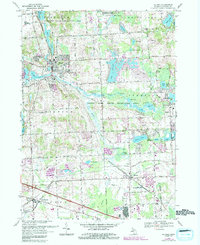
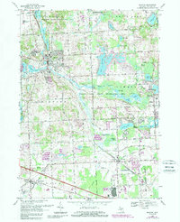
1969 Map of Milford
USGS Topo · Published 1989About this map
The Huron River winds through this Oakland County landscape, anchoring a region of dense glacial lakes and evolving suburban corridors in the late 1960s. Milford serves as the primary hub, showing a concentrated grid of streets near Hubbell Pond and the Fish Hatchery, while the village of Wixom further south highlights the area's industrial and transport links. The presence of the Chesapeake and Ohio and Grand Trunk Western railroads illustrates the vital shipping lanes that supported the local economy before the massive expansion of the regional highway system.
Find a feature on this map
53 named features on this map. Tap any name to fly to it.
Don’t see what you’re looking for? This feature index may not catch every label — zoom into the map to look around manually.
Map Details
Editions of this 1969 Milford Map
5 editions found
Other maps of this area

1902 · South Lyon
USGS Topo · 1:62,500

1904 · Ann Arbor
USGS Topo · 1:125,000

1905 · Wayne
USGS Topo · 1:62,500

1906 · South Lyon
USGS Topo · 1:62,500

1907 · Pontiac
USGS Topo · 1:62,500

1908 · Ann Arbor
USGS Topo · 1:125,000

1909 · Milford
USGS Topo · 1:62,500

1912 · Wayne
USGS Topo · 1:62,500

1936 · Wixom
USGS Topo · 1:31,680

1936 · Highland
USGS Topo · 1:31,680
Featured Places
- Novi, MI
- Commerce Charter Township, MI
- White Lake Charter Township, MI
- Lyon Charter Township, MI
- Highland Charter Township, MI