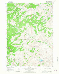
1956 Map of Milk Creek
USGS Topo · Published 1967About this map
Shoshone National Forest defines the western edge of this territory, where the High Plains meet the dramatic geological formations of the Absaroka Range. The map reveals a landscape dictated by seasonal water and cattle ranching, anchored by established outposts such as the LU Cow Camp, TA Cow Camp, and the Anderson Sawmill in the north. The presence of several temporary sites like the Dvarishkis Hunting Camp indicates the area's importance for both recreation and industry during the mid-1950s. Named peaks such as Sugar Loaf Mountain and Squaw Teat Butte overlook a complex network of drainages including Milk Creek and Cottonwood Creek. Of particular interest is the curiously named The Holy City rock formation in the southwest, while scattered Oil Wells hint at the mineral extraction occurring alongside traditional grazing on this rugged Wyoming terrain.
Find a feature on this map
36 named features on this map. Tap any name to fly to it.
Don’t see what you’re looking for? This feature index may not catch every label — zoom into the map to look around manually.
Map Details
Editions of this 1956 Milk Creek Map
3 editions found
Other maps of this area

1904 · Kirwin
USGS Topo · 1:125,000

1906 · Kirwin
USGS Topo · 1:125,000

1955 · Thermopolis
USGS Topo · 1:250,000

1956 · Milk Creek
USGS Topo · 1:24,000

1956 · Twentyone Creek
USGS Topo · 1:24,000

1956 · Soapy Dale Peak
USGS Topo · 1:24,000

1956 · Adam Weiss Peak
USGS Topo · 1:24,000

1958 · Thermopolis
USGS Topo · 1:250,000

1962 · Thermopolis
USGS Topo · 1:250,000
1965 · Eagle Nest Ranch
USGS Topo · 1:24,000