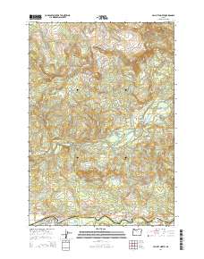
2014 Map of Mill City North
USGS Topo · Published 2014About this map
Mill City and the neighboring community of Gates anchor the southern edge of this 2014 survey, positioned along the banks of the North Santiam River. The landscape is defined by the steep transitions from the river valley into the timbered heights of House Mtn and Sweet Spring Mtn. This area serves as a primary corridor for travel between the Santiam canyon and the high Cascades, following the path of Or-22 and the historic route of Railroad Ave.
Find a feature on this map
59 named features on this map. Tap any name to fly to it.
Don’t see what you’re looking for? This feature index may not catch every label — zoom into the map to look around manually.
Map Details
Editions of this 2014 Mill City North Map
This is the sole edition of this map. No revisions or reprints were ever made.
Other maps of this area

1929 · Mill City
USGS Topo · 1:125,000

1951 · Lyons
USGS Topo · 1:62,500

1951 · Snow Peak
USGS Topo · 1:62,500

1953 · Salem
USGS Topo · 1:250,000

1954 · Salem
USGS Topo · 1:250,000

1955 · Mill City
USGS Topo · 1:62,500

1956 · Quartzville
USGS Topo · 1:62,500

1960 · Salem
USGS Topo · 1:250,000

1962 · Salem
USGS Topo · 1:250,000

1963 · Salem
USGS Topo · 1:250,000