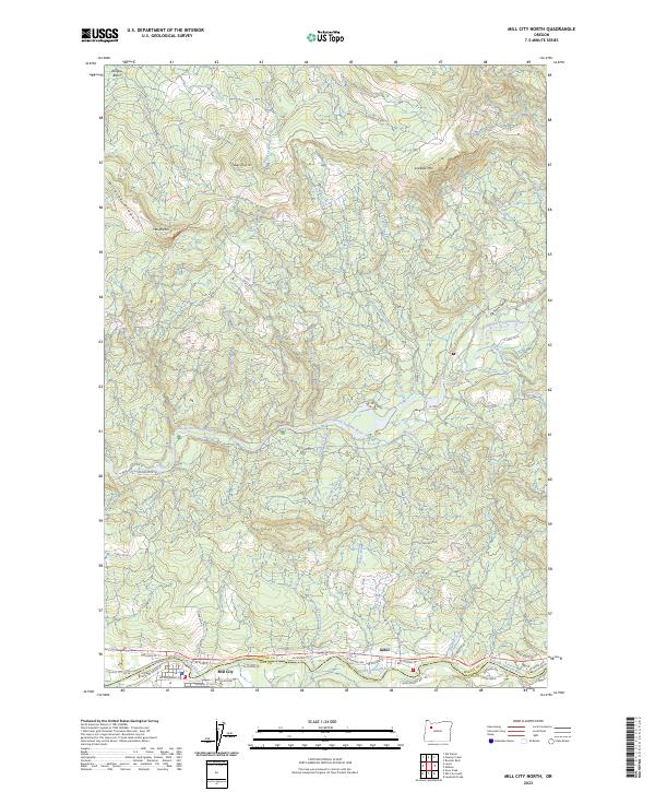
2023 Map of Mill City North
USGS Topo · Published 2023About this map
The North Santiam River and its fork, the Little North Santiam River, define the rugged geography of this Marion and Linn County borderland. The communities of Mill City and Gates anchor the southern edge of the map, where the river valley transitions into the steep elevations of the Cascade foothills. The intricate network of residential streets in Mill City, such as NW Alder St and SW Evergreen St, contrasts with the vast, undeveloped timberlands to the north. These uplands are marked by prominent summits including Lookout Mtn and House Mtn, alongside the high profile of Wildcat Ridge. This terrain is deeply etched by a complex drainage system, including the protected corridor of the Elkhorn Creek Wild and Scenic River. Researchers will find a landscape where the river-bottom settlements of Elkhorn Valley represent the thin margin of human habitation against the steep, creek-cut ridges of the Abiqua Basin.
Find a feature on this map
70 named features on this map. Tap any name to fly to it.
Don’t see what you’re looking for? This feature index may not catch every label — zoom into the map to look around manually.
Map Details
Editions of this 2023 Mill City North Map
This is the sole edition of this map. No revisions or reprints were ever made.
Other maps of this area

1929 · Mill City
USGS Topo · 1:125,000

1951 · Lyons
USGS Topo · 1:62,500

1951 · Snow Peak
USGS Topo · 1:62,500

1953 · Salem
USGS Topo · 1:250,000

1954 · Salem
USGS Topo · 1:250,000

1955 · Mill City
USGS Topo · 1:62,500

1956 · Quartzville
USGS Topo · 1:62,500

1960 · Salem
USGS Topo · 1:250,000

1962 · Salem
USGS Topo · 1:250,000

1963 · Salem
USGS Topo · 1:250,000